Click on the images in each section below to see more maps and information
Projects:
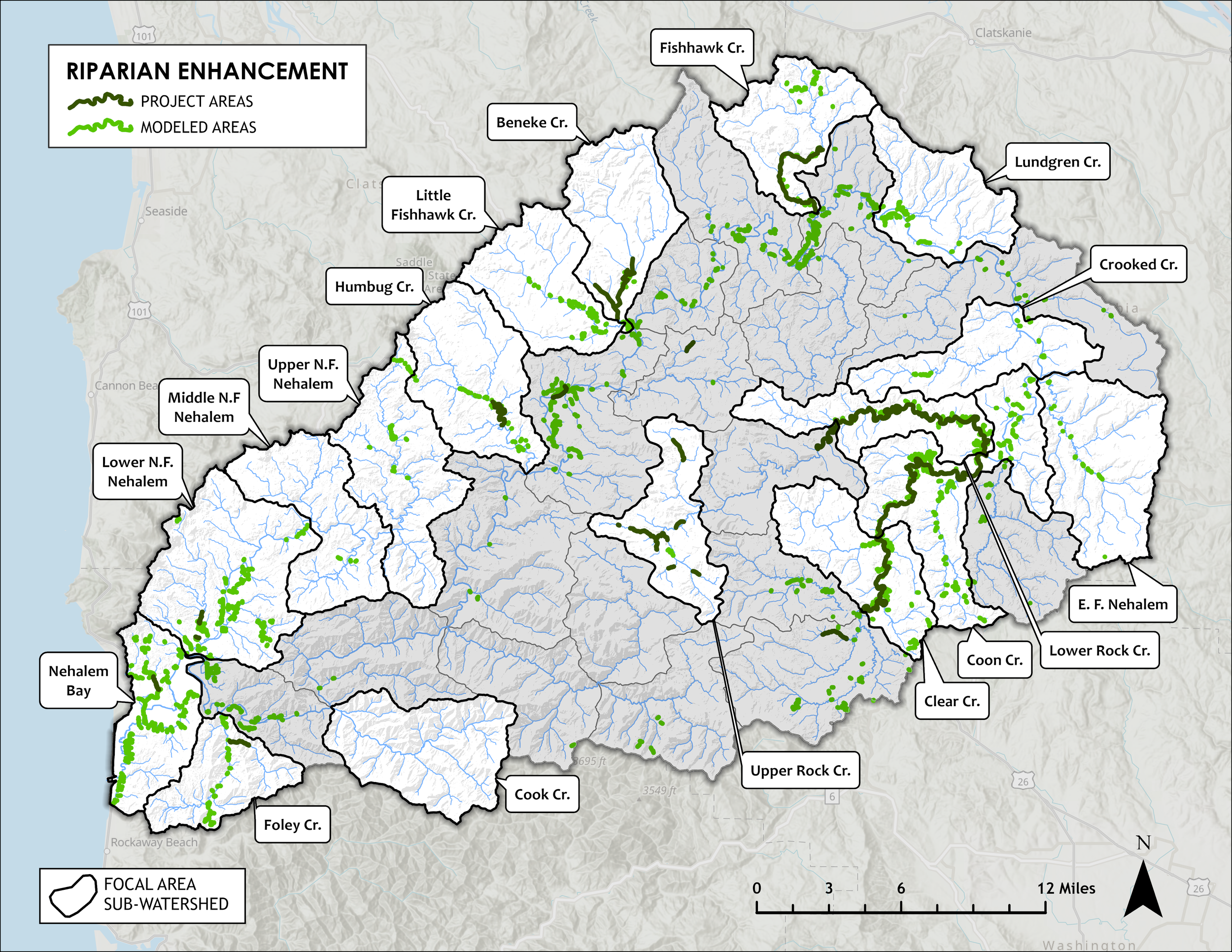
Nehalem Strategic Action Plan (NSAP) Maps
The Nehalem Basin Partnership asked me to help re-work their Strategic Action Plan for the Protection & Restoration of Coho Salmon Habitat. I conducted new riparian planting and fish passage barrier analyses to prioritize restoration efforts, and created maps to showcase the newly prioritized sub-watersheds.
Click on either map below to learn more

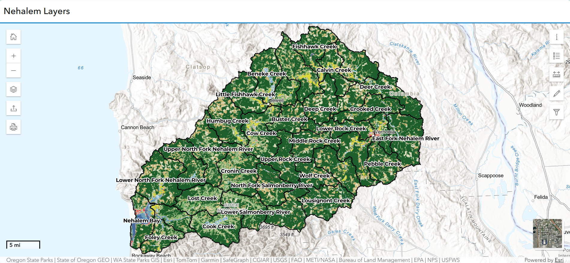
Nehalem Basin Partnership Data Layers Web Application
The Upper Nehalem Watershed council wanted a web map created with all of the relevant layers from their vast trove of GIS data, and an application that would allow non-GIS users to quickly and easily view and export maps for project prioritization and internal communications. I compiled data layers into a web map and created an instant app with functions to allow export and printing.
Click on the image below to learn more and explore the app for yourself
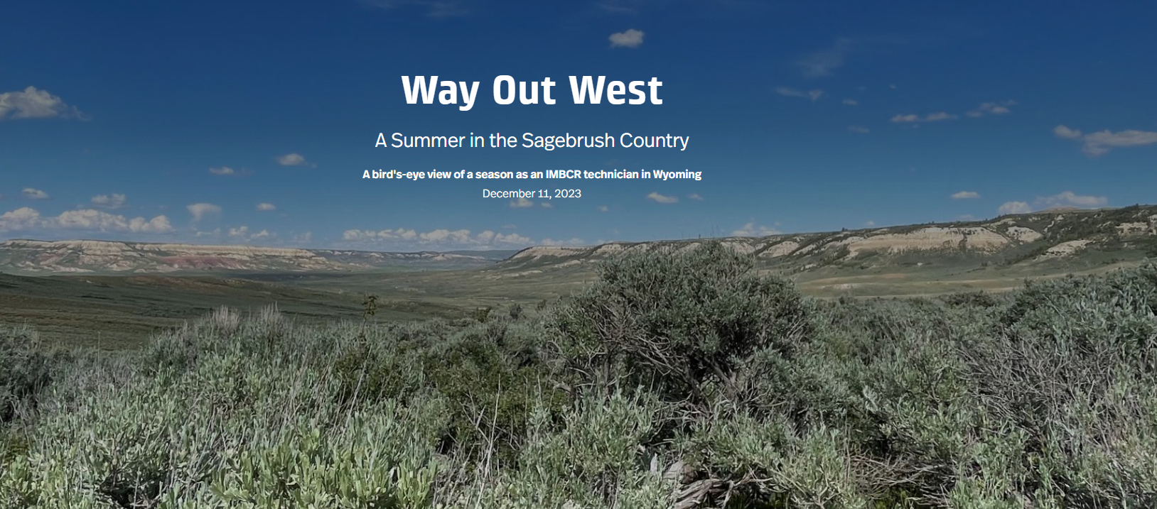
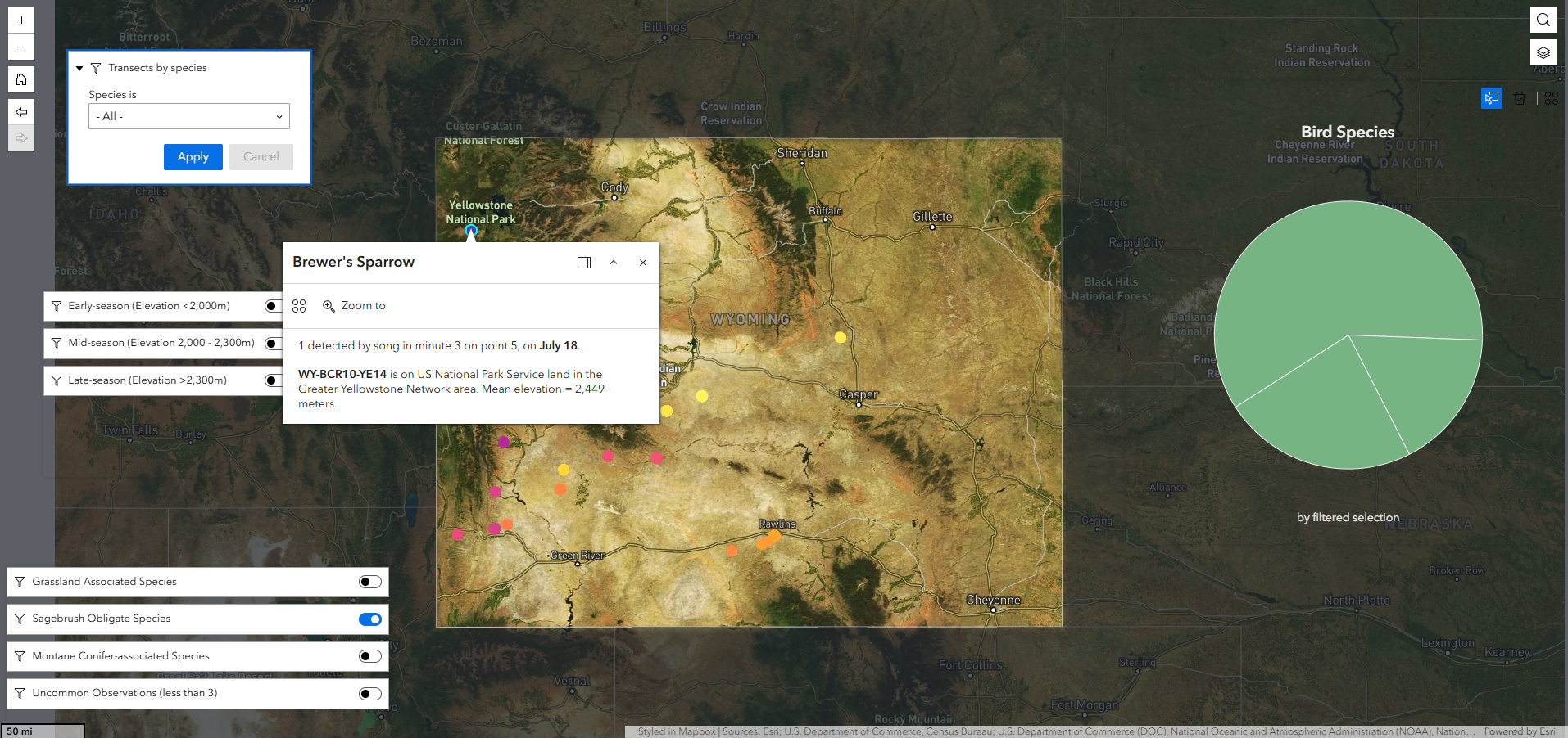
Bird Conservancy of the Rockies Storymap and Web Experience
I made this Storymap to showcase what a field season in Wyoming can look like for an IMBCR (Integrated Monitoring in Bird Conservation Regions) Point-Count Technician, and some of the beautiful places, bird species, and challenges I encountered throughout the state.
The Web Experience application allows users to explore the bird species that I located in each survey site, as well as a summary of early, mid, and late-season or habitat-associated birds and their locations.
Click on either image below to learn more
Other Selected Works:
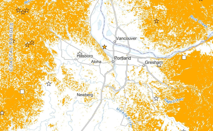
Chanterelle Habitat Analysis - Mapping Forest Treasures
An analysis of potential chanterelle mushroom habitat near Portland, Oregon. I used 6 predictive factors derived from LIDAR and satellite imagery (elevation, slope, aspect, potential soil moisture, forest stand age, and NLCD landcover type) alongside iNaturalist data to conduct a supervised classification of potential chanterelle mushroom habitat. I also conducted a network analysis to isolate potential habitat within a 45-minute drive from Portland, OR.
Click on the image below to learn more
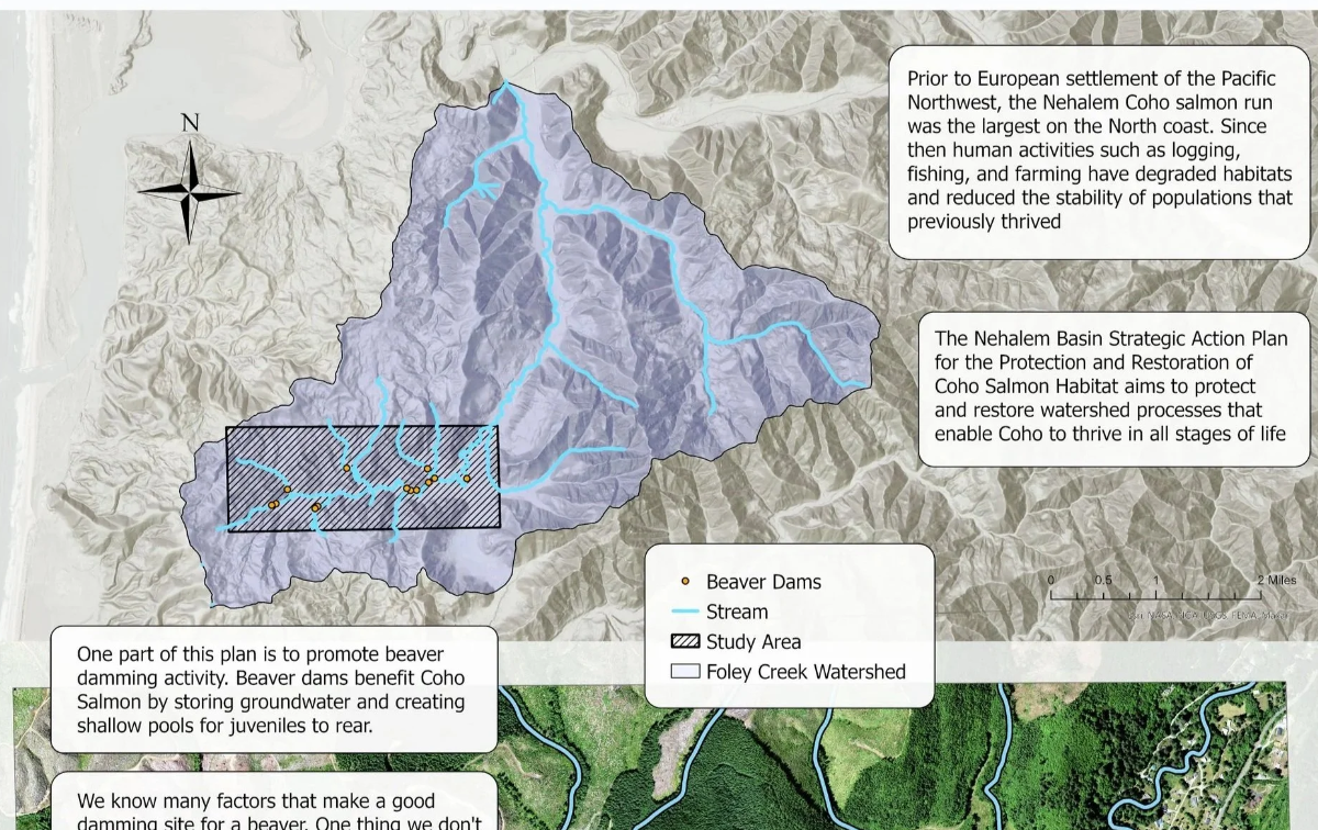
Foley Creek Dam Analysis - Do Beavers Like it Bare?
I created this project for the Nehalem Basin Partnership in December 2023 before becoming their intern. I used ArcGIS Pro and Excel to examine the relationship between beaver dams and forest clearings in the Foley Creek Watershed in Northwestern Oregon.
Click on the image below to learn more
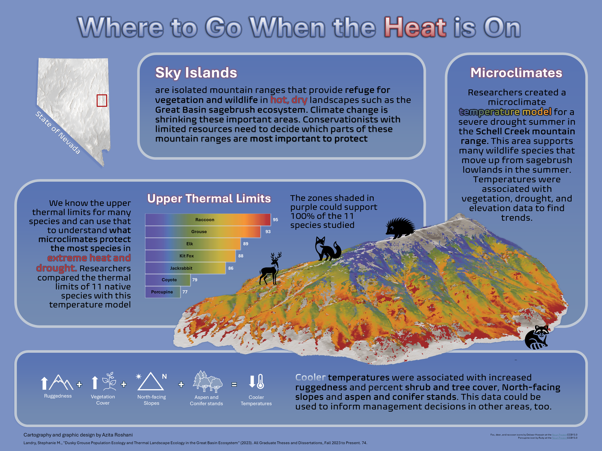
Mapping Thermal Refugia - Where to Go When the Heat is On
An infographic to visualize research on thermal landscape ecology in the Great Basin Ecosystem. The featured mountain range is color-coded by recorded high temperatures during a severe summer drought. The viewer can use the bar chart to see which animals would have possibly needed to move to different microclimates to avoid heat stress.
Click on the image below to learn more
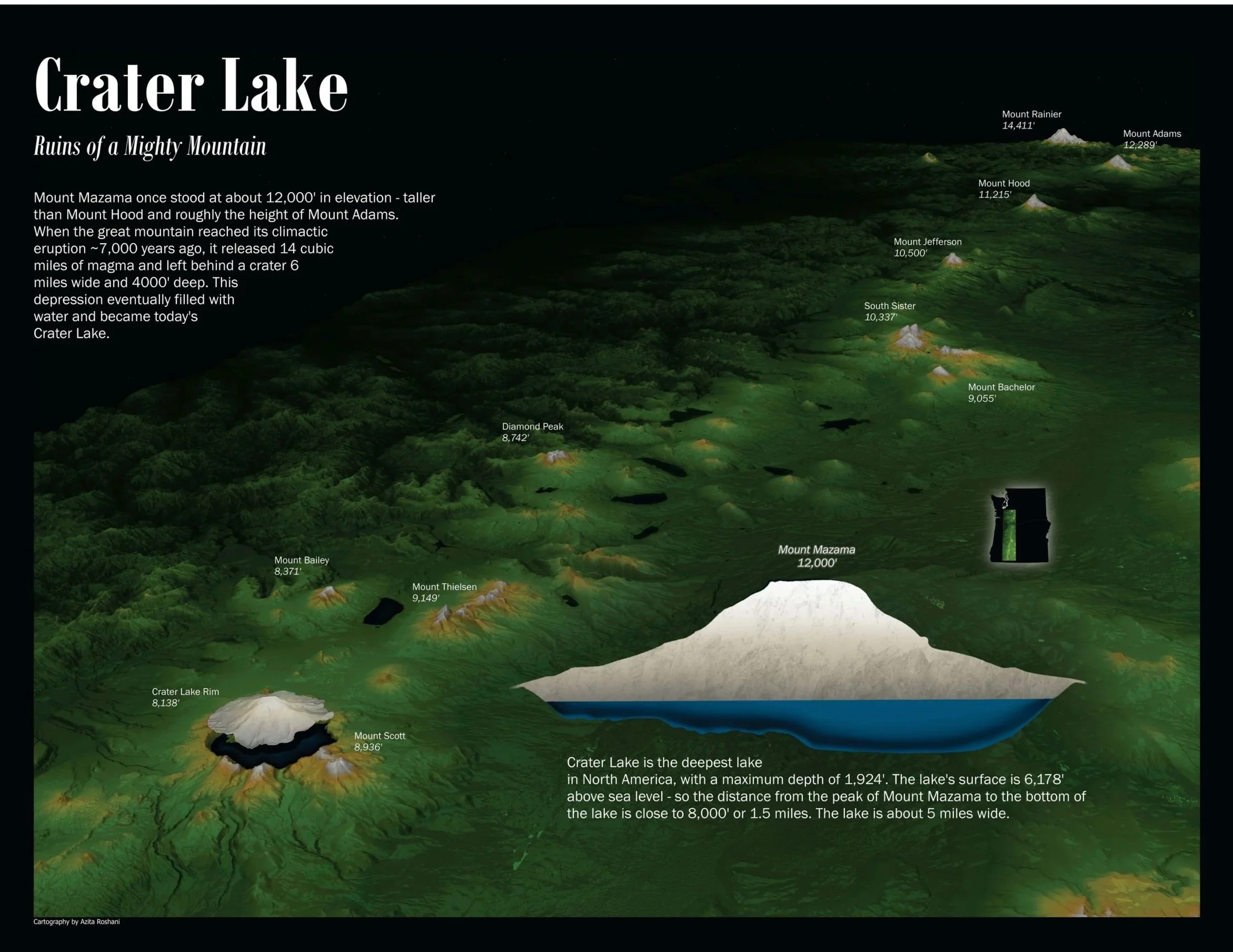
Crater Lake - Ruins of a Mighty Mountain
A map for the curious to visualize and imagine the place of Mount Mazama in the Cascade Mountains. I used a DEM of Mount Adams, a roughly similar-sized mountain, to create a floating visual representation of how Mount Mazama could have looked alongside the other Cascades.
Click on the image below to learn more