Nehalem Strategic Action Plan (NSAP) Maps
The Nehalem Basin Partnership asked me to help re-work their Strategic Action Plan for the Protection & Restoration of Coho Salmon Habitat. I conducted new riparian planting and fish passage barrier analyses to prioritize restoration efforts, and created maps to showcase the newly prioritized sub-watersheds and reaches.
Date - April 2026
Location - Northwestern Oregon, the Nehalem River Watershed
Software Used - ArcGIS Pro, TerrainWorks Netmap
Data Sources - Lower Nehalem Watershed Council (LNWC), Upper Nehalem Watershed Council (UNWC), TerrainWorks, USGS, NOAA, Oregon DEQ, ODFW, ODF, Weyerhaeuser, ESRI, Bio-Surveys LLC.
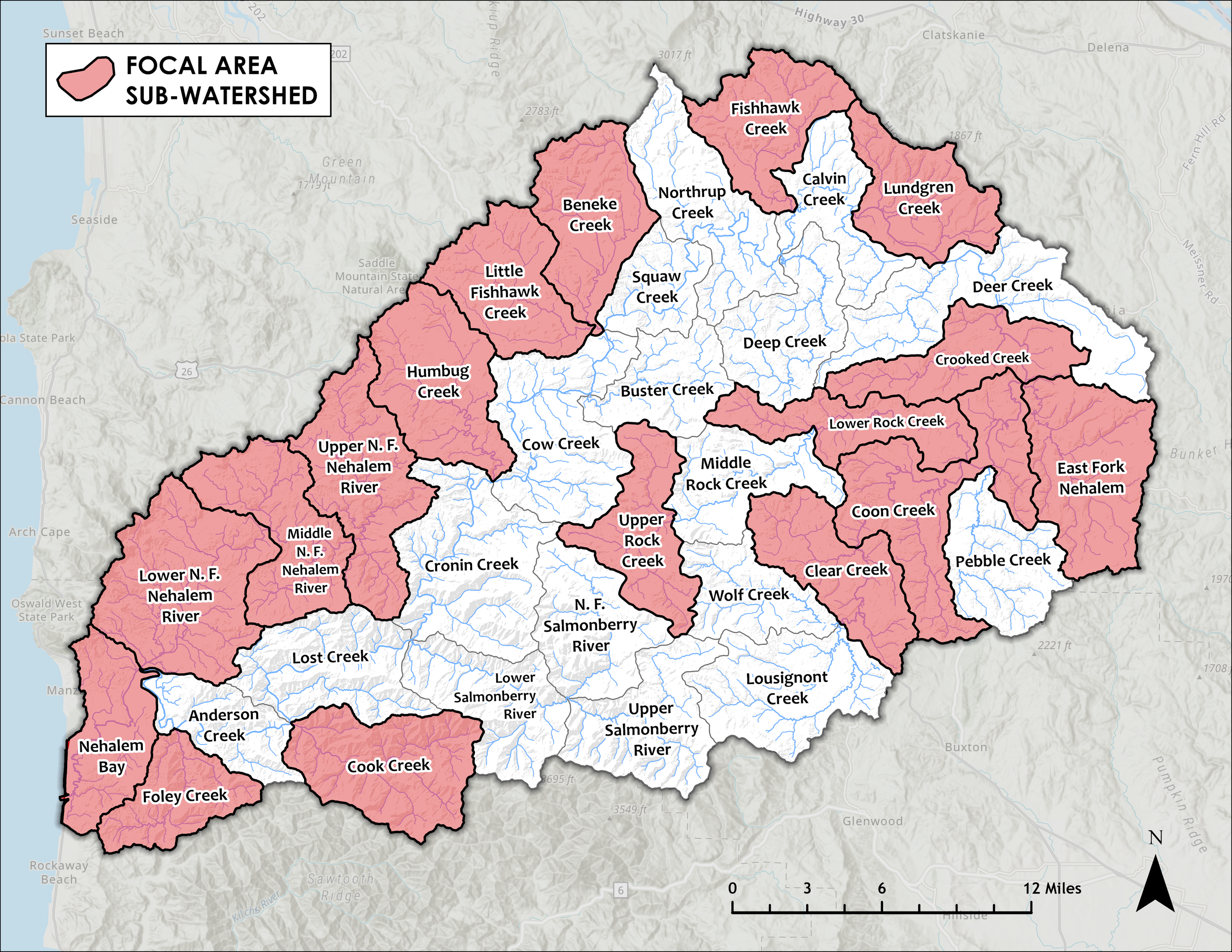
Focal Area Sub-Watersheds
This map outlines the newly prioritized sub-watersheds in the Nehalem. Sub-watersheds were chosen for priority in project planning based on a ranking of miles of Coho salmon anchor habitat, high intrinsic potential for beaver colonization, miles blocked by fish passage barriers, and unique Coho life-history patterns.
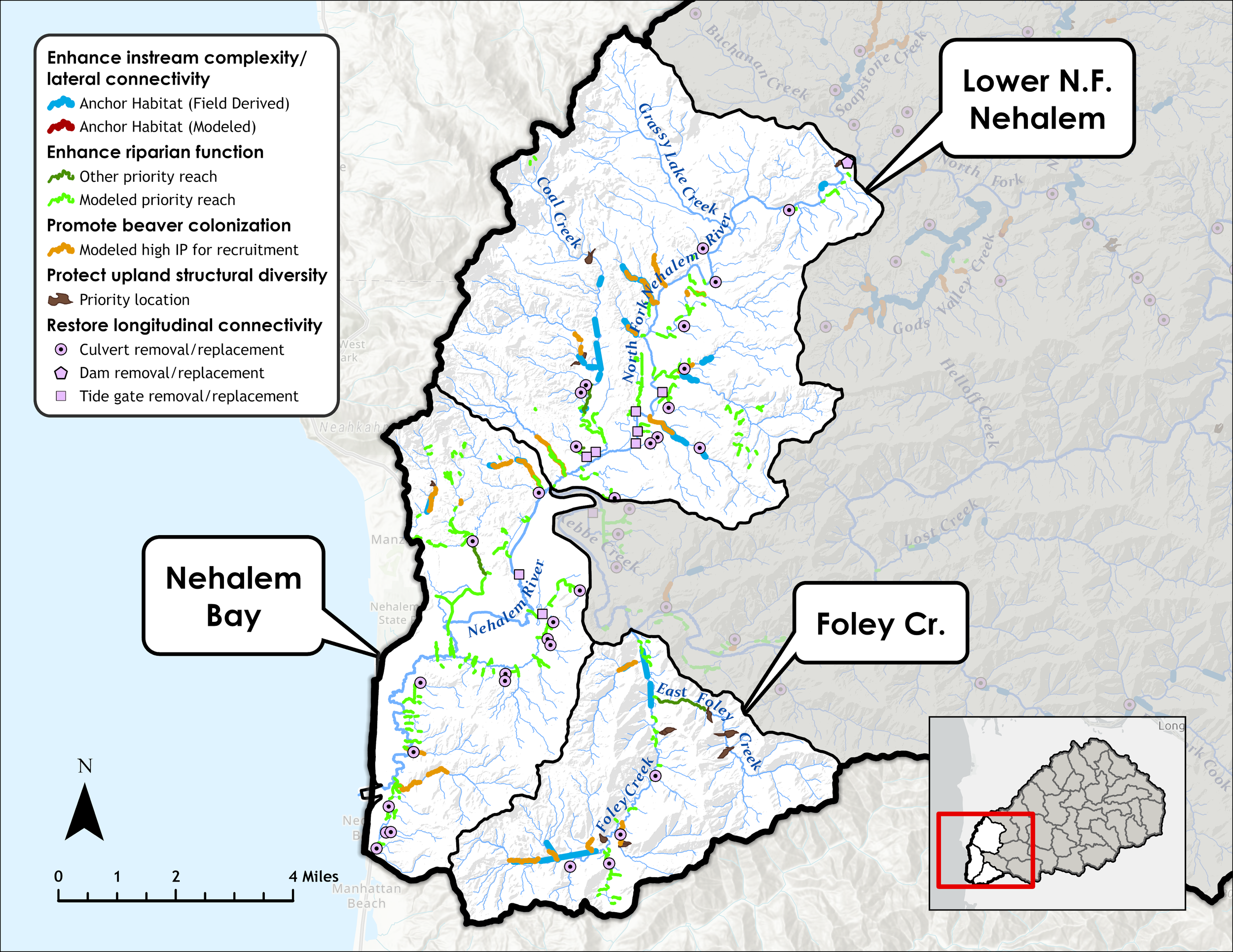
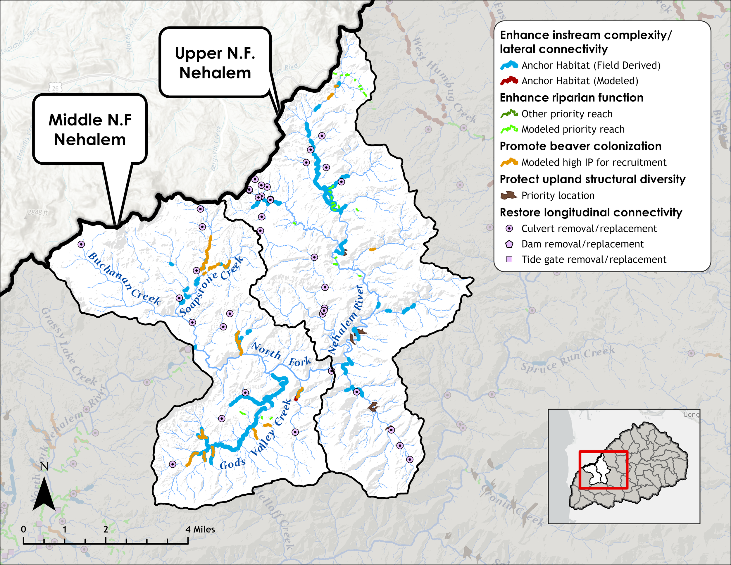
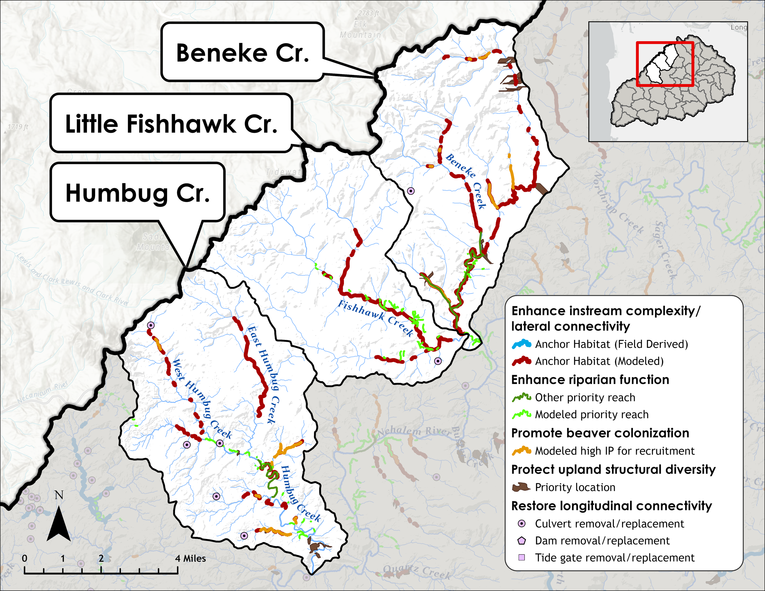
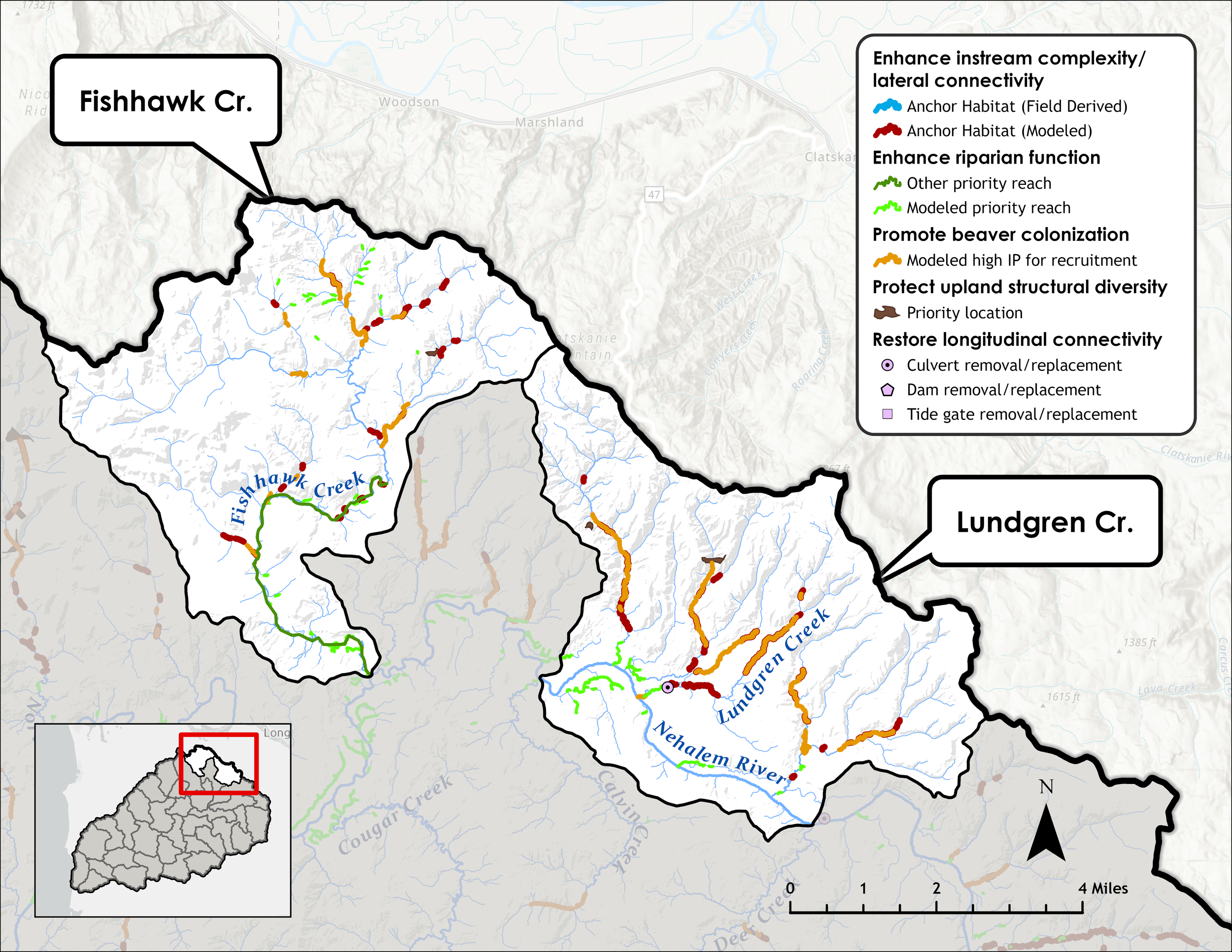
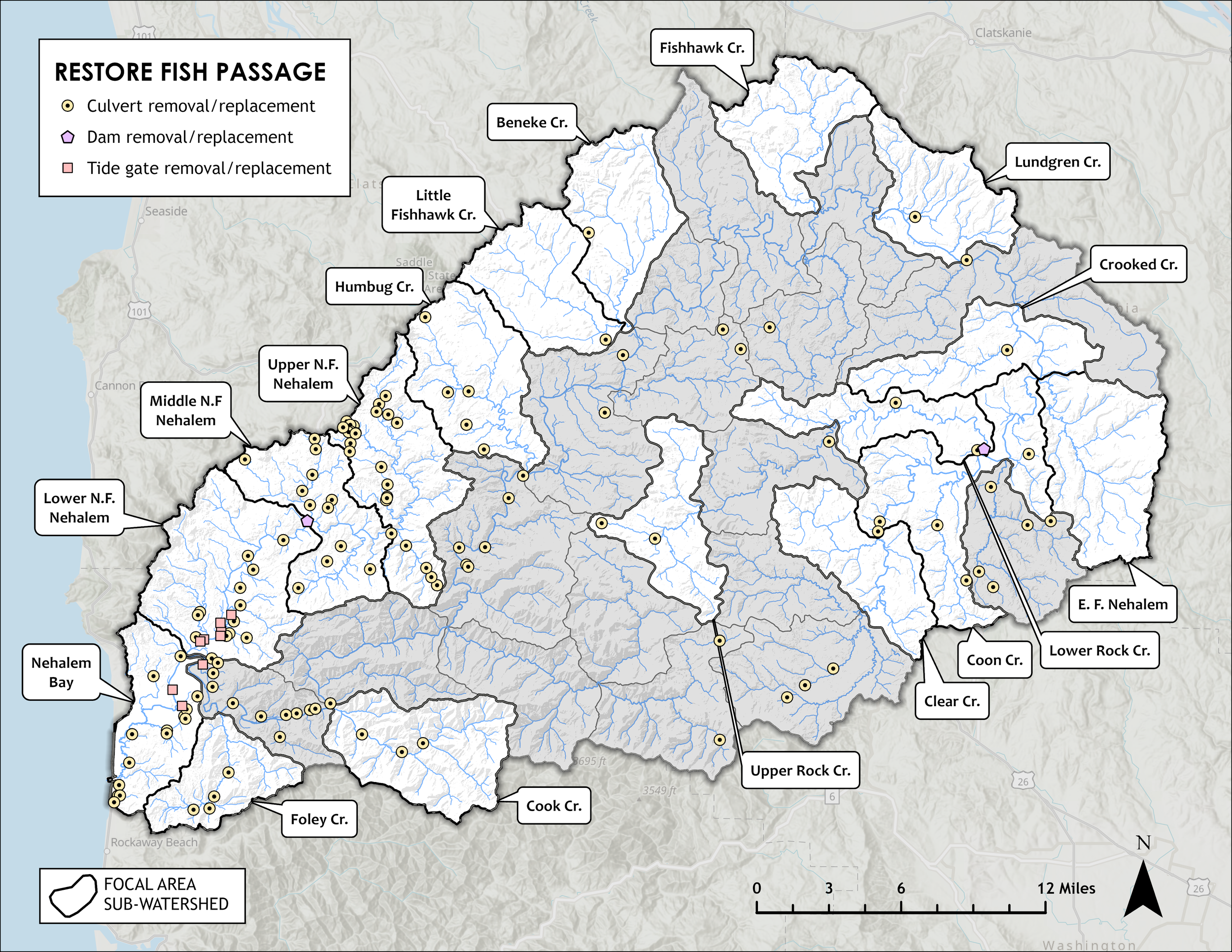
Restore Fish Passage
Sub-watersheds were ranked based on total upstream mileage blocked by barriers within each, with partial barriers given a lower weight than fully blocked barriers. Barrier data was compiled from a number of sources including the Oregon Fish Passage Barriers Dataset and the staff at UNWC and LNWC.
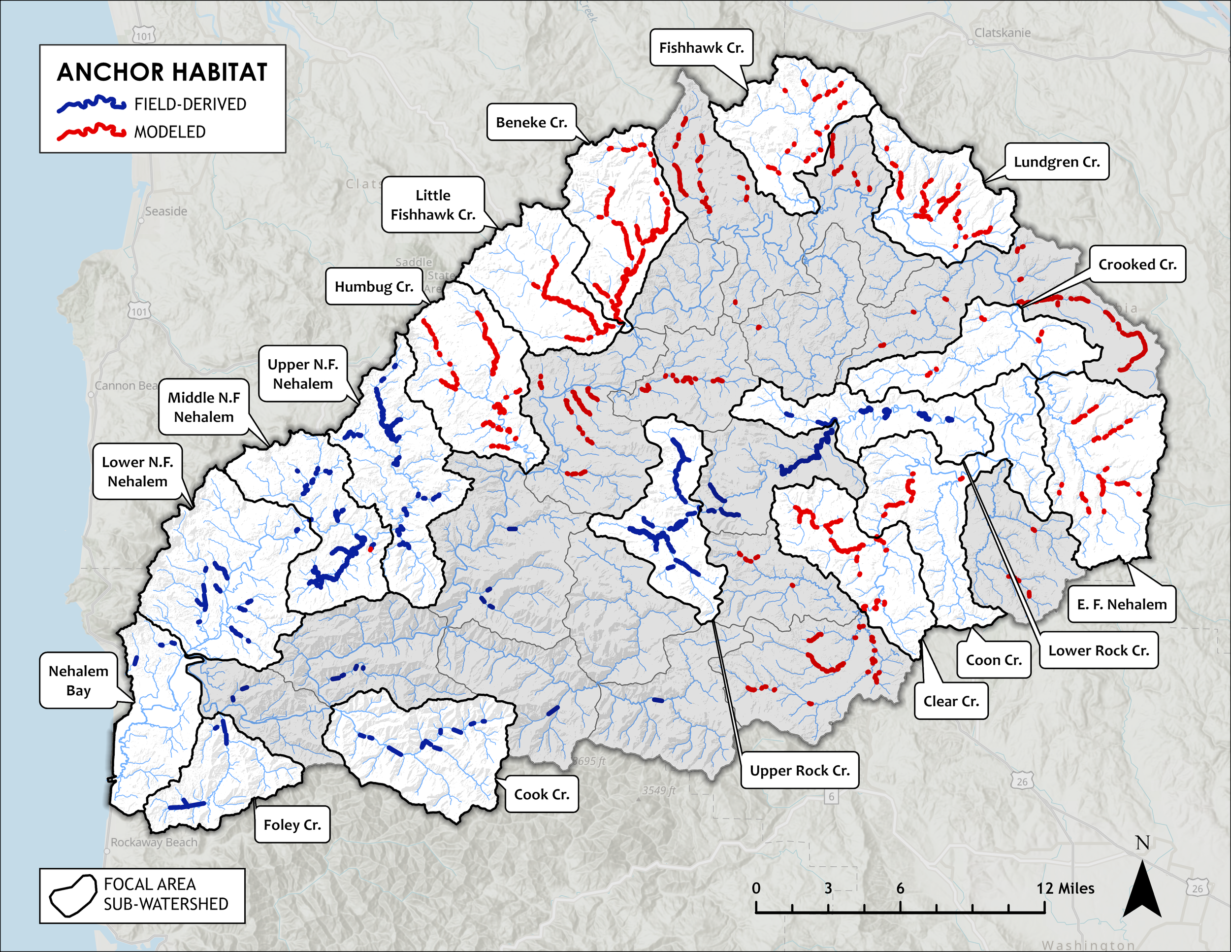
Anchor Habitat
Stream reaches that support the complete Coho freshwater life history and meet the seasonal habitat needs of Coho from egg to smolt outmigration are considered anchor habitat. These sites have an optimum gradient of 1-2.5%, a high potential for floodplain interaction characterized by broad floodplains and low terraces, and contain an accumulation of spawning gravels.
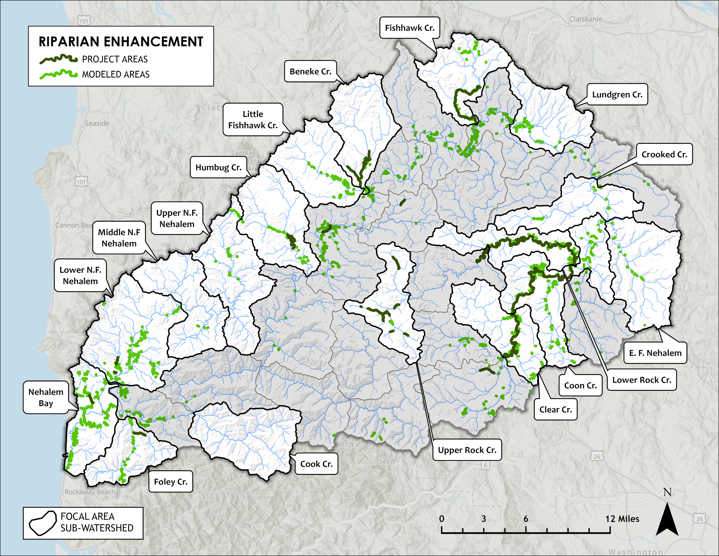
Riparian Enhancement
Riparian priorities were chosen based on the difference between current shade thermal energy and estimated maximum shade thermal energy that could be provided by riparian cover. This provides an index of where increasing shade would have the greatest benefit for stream cooling.
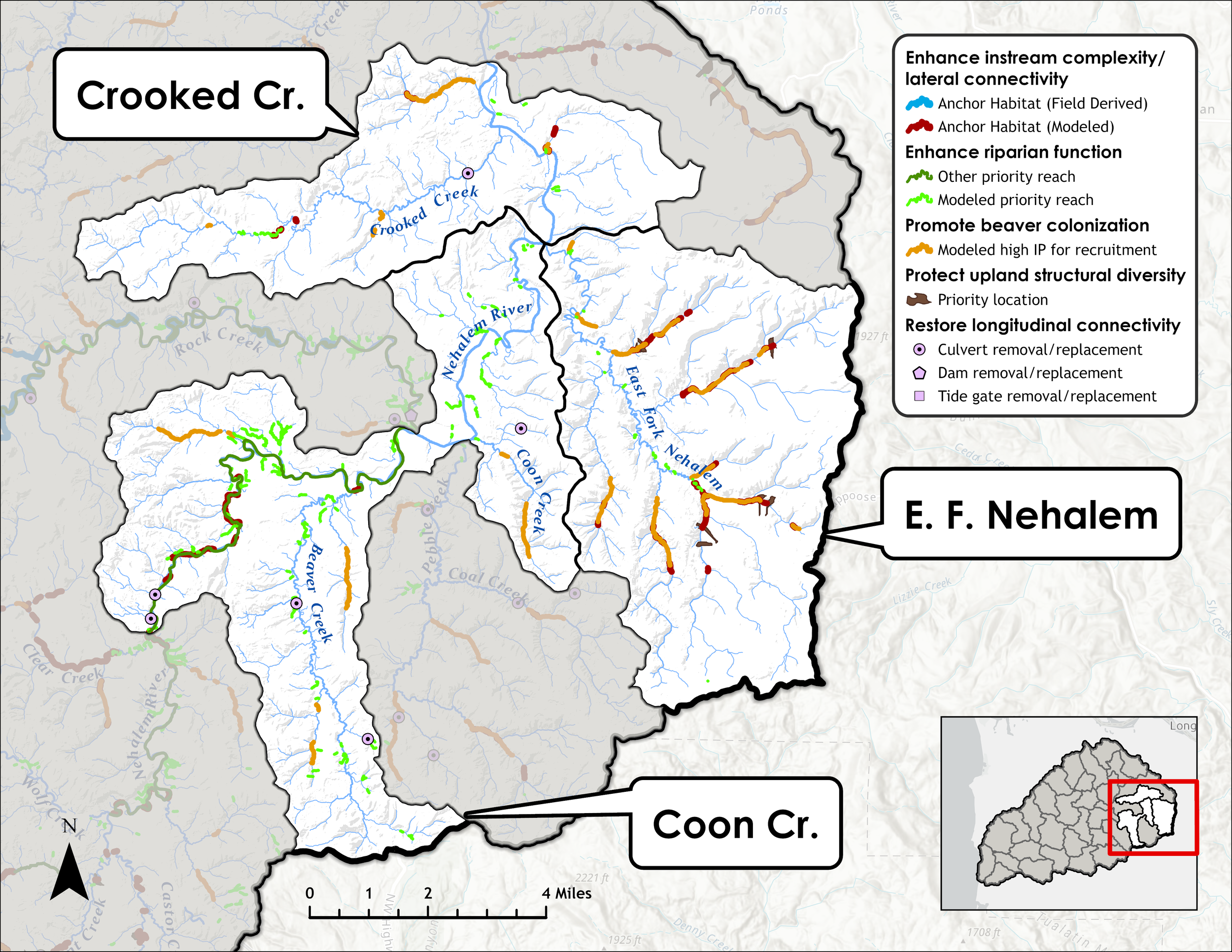
Priority Reaches by Restoration Strategy in the Focal Areas
The maps below present the river reaches, barriers, and upland locations identified as the highest priorities for implementing the strategies presented in the NSAP. These locations represent the areas where investment in protection and restoration projects will provide the greatest benefit and highest return on investments made in Nehalem Coho recovery.