Nehalem Basin Partnership Data Layers Web Application
I designed this ESRI Instant App so that the Upper Nehalem Watershed Council’s director and other users can explore our data and create their own simple maps for planning and sharing information. I compiled layers from the UNWC’s data repository and many other sources including Oregon GEOHUB and ODFW. There are two sharing options - export and print - which enable the user to decide between different layouts, legend designs, and file formats. This map is a living document that is being added to continuously as the Nehalem Strategic Action Plan for Coho salmon recovery is updated for 2026.
Date - March 2026 (ongoing)
Location - Northwestern Oregon, the Nehalem River Watershed
Data Sources - Lower Nehalem Watershed Council (LNWC), Upper Nehalem Watershed Council (UNWC), TerrainWorks NetMap, USGS, NOAA, Oregon DEQ, ODFW, ODF, Weyerhaeuser, ESRI, Bio-Surveys LLC.
Click on the image below to explore the application for yourself
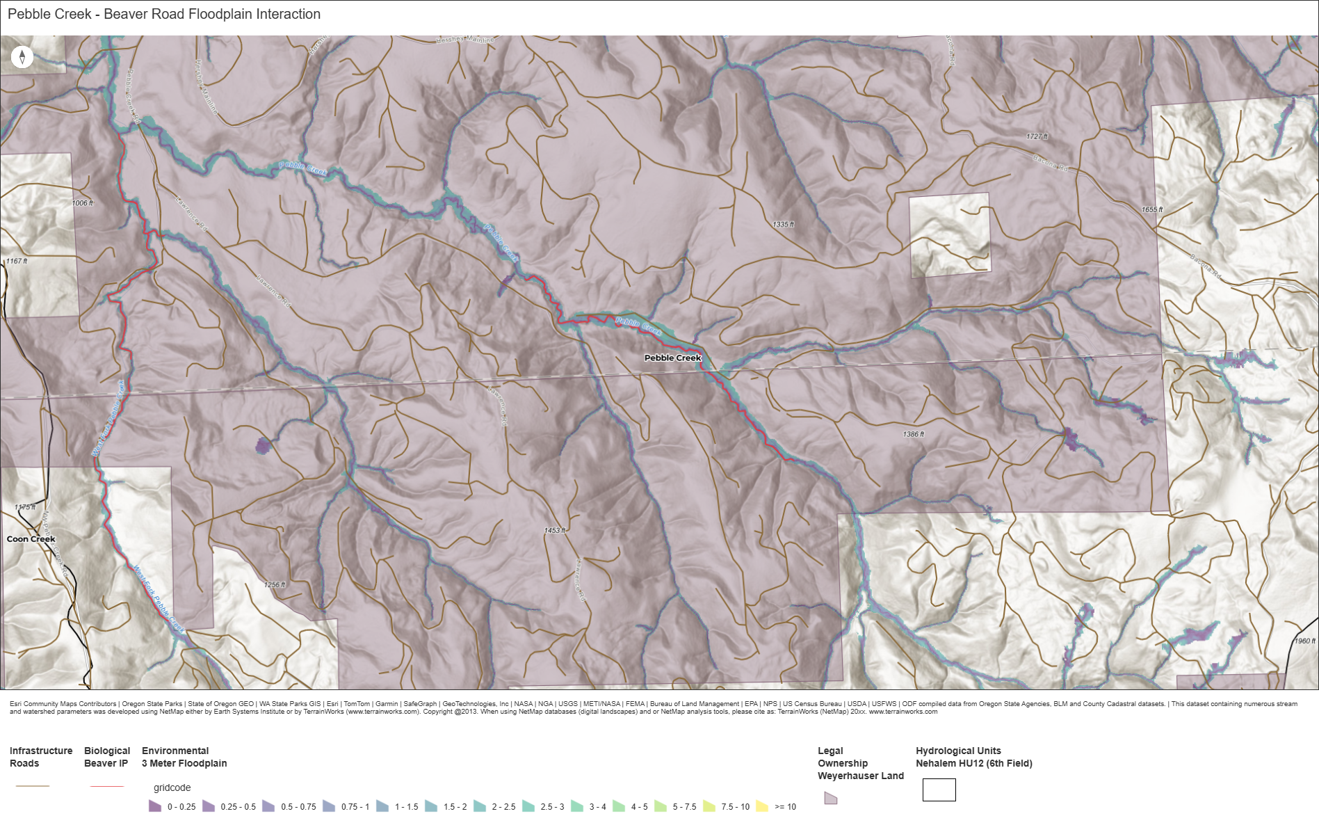
Example Map - Beaver Road Floodplain Interaction
Below is an example of a map that could be made by a non-GIS user to answer a specific question: in what areas on Weyerhaeuser land with high beaver IP should we avoid prioritizing beaver habitat restoration because of potential conflicts with road infrastructure? The 3 meter floodplain layer represents where flooding could occur given a 3-meter high beaver dam constructed along a stream reach. One can see here that for a large part of the section of Pebble Creek with high beaver IP, damming on the creek could result in flooding a road - therefore, beaver activity should probably not be actively encouraged there above places with less potential conflict.