Bird Conservancy of the Rockies Storymap and Web Experience Application - Way Out West
This Storymap follows my journey as I conducted avian point-counts in 2023. I made this Storymap to showcase what a field season might look like for an IMBCR (Integrated Monitoring in Bird Conservation Regions) Point-Count Technician, and some of the beautiful places, bird species, and challenges I encountered throughout the state of Wyoming.
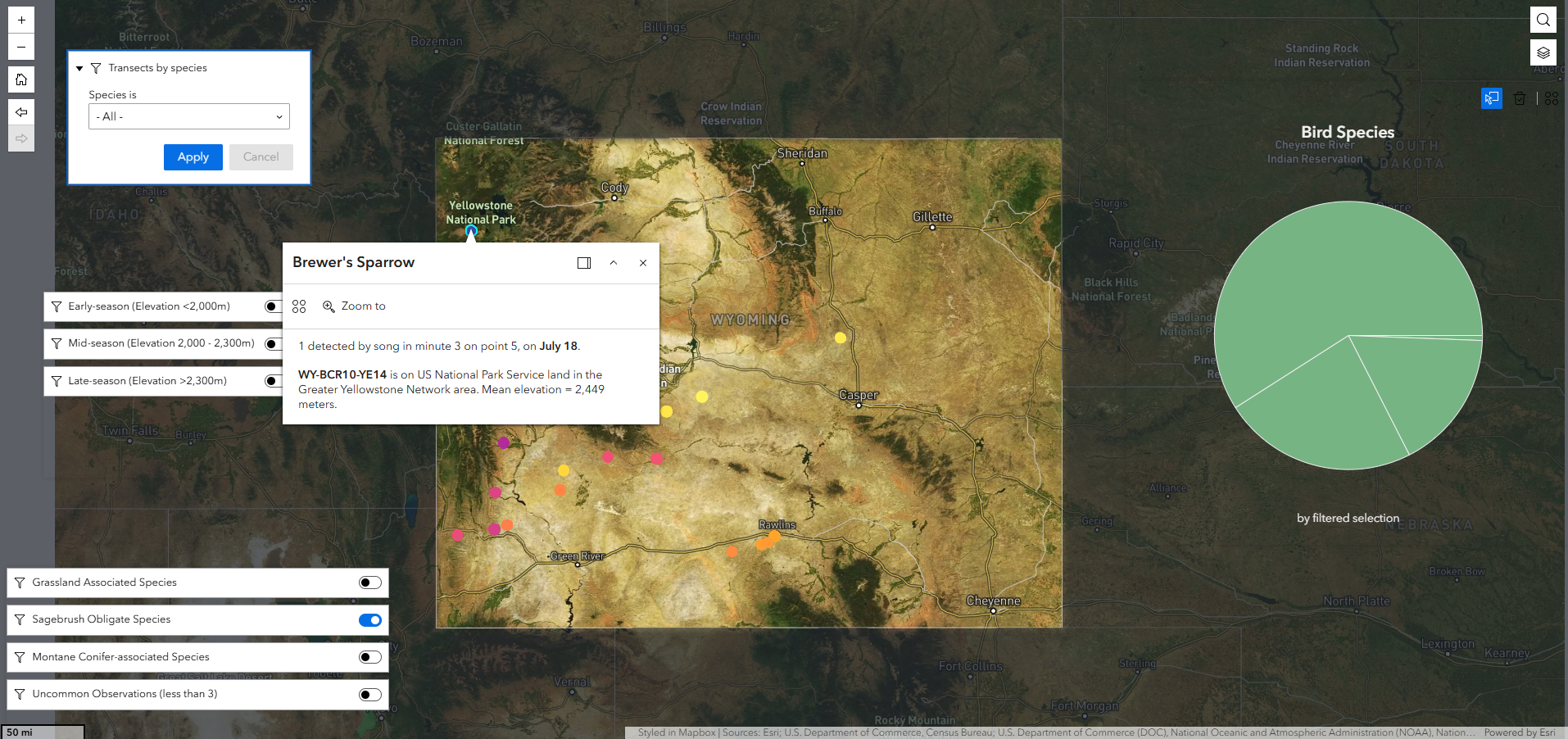
The Web Experience application allows users to explore the bird species that I located in each survey site, as well as a summary of early, mid, and late-season or habitat-associated birds and their locations.
Date - December 2023
Location - Wyoming
Data Sources - Bird Conservancy of the Rockies, ESRI, U.S. Department of Commerce, Census Bureau, National Oceanic and Atmospheric Administration (NOAA), National Ocean Service (NOS), National Geodetic Survey (NGS), John Nelson
Click on the image below to open the Storymap
Putting Birds on the Map - Web Experience Application
This web application allows users to explore the bird species that I located in each survey site, as well as a summary of early, mid, and late-season or habitat-associated birds and their locations.
Click the arrow under "Transects by Species" to scroll through a list of the species detected on survey points throughout the state. Select a species and click "Apply" to see all the transects where it was counted. Scroll back to "all" and click "Apply" to remove the filter.
Select sites by elevation zone, and hover over slices in the pie chart to see which species were most detected in each zone
Select a category of association to see where birds that are known to rely on particular habitats were found. Can you find a high-elevation transect with sagebrush-obligate species? How about low elevation? What birds were most common in each elevation zone?
Click on the image below to open the web application