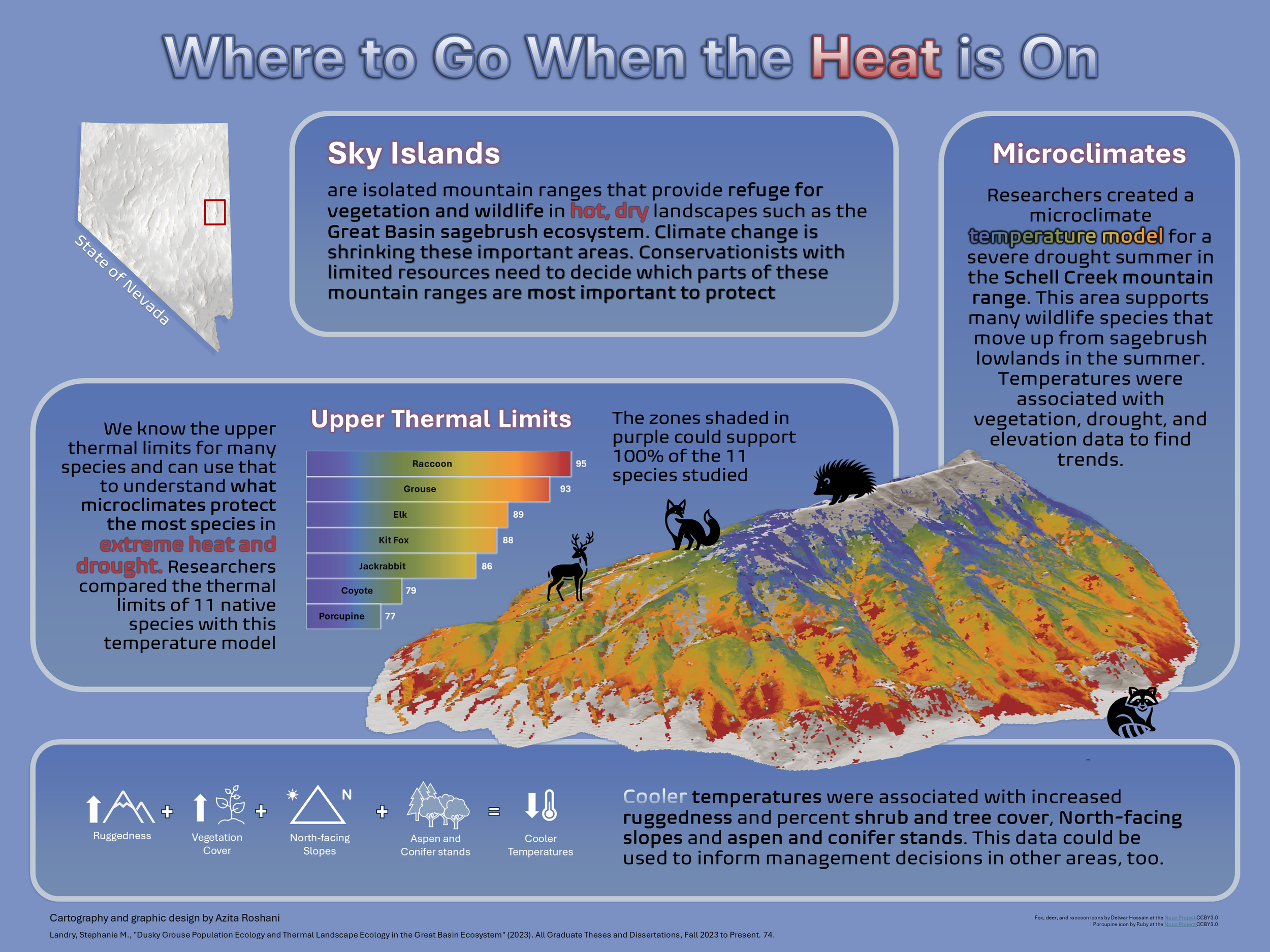
Where to Go When the Heat is On - Mapping Thermal Refugia in the Sky Islands of Nevada
An infographic to visualize the research of Stephanie M. Landry on thermal landscape ecology in the Great Basin Ecosystem
Date - March 2025
Location - East Central Nevada
Software Used - ArcGIS Pro, PowerPoint, Excel
Primary GIS Tools and Methods - Hillshade, Classify Raster
Data Sources - ESRI, Stephanie Landry, The Noun Project (Delwar Hossain, Ruby)